
If you’re going to do the #GrandTetonPicnic, please, for me, and for you, swim ACROSS Jenny lake. I hear a lot of people are swimming from the East overlook to the South boat dock and back, which is far less committing. If you do it this way, you don’t get to swim straight at the Grand, which was the reason I did this silly thing in the first place.
A couple of Colorado boys swam East to South and vice versa for Outside TV, and many picnickers are now duplicating their route. This variation made sense to Jason and Mike, who weren’t sure of the original route. The East-South swim is the same distance as the East-West swim, and deposits you closer to the Lupine Meadows trailhead, but in my opinion, If you do it this way, you’re not getting the full Monty.
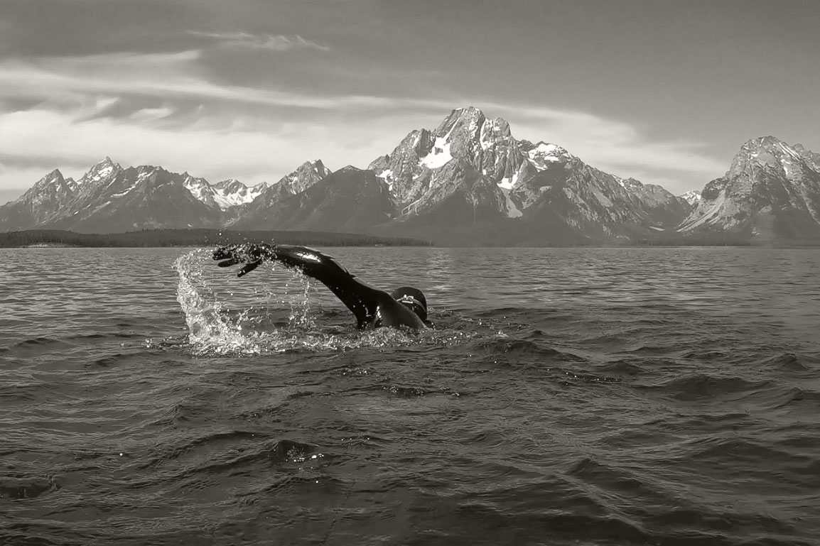
I mean, you can do whatever you want. It’s your own experience. But the essence of the Grand Teton Picnic is standing on the west shore of Jenny Lake, utterly drained by all the biking, swimming, walking, climbing, and descending you’ve already done, and mustering the will to swim back ACROSS that big, cold lake.

It’s scary, but you’ve got this. The lake is big but it’s not THAT big. It’s cold, but you’re in a wetsuit. And as I say to myself a few hundred times per crossing, you’re gonna get there. When your feet finally hit the slimy rocks beneath the East overlook, that’s an amazing feeling. You’ve vanquished yourself, all your doubts and fears. This is the prize, and makes the ensuing bike ride past the gorgeous dragon you’ve just slayed even better.
Swimming Jenny Lake South to East instead of West to East … it’s kind of the Weight Watchers’ Lasagna of Picnicking. No offense. Honestly, if you’ve done it this way, I envy you. You get to do the Picnic again for the first time.
Thank you for this extra post. I’ve wanted to do this for some time now but after reading this. Now I just wanna create this same challenge in my home town. Thank you
Your website resonates with me! Your will and mine bear some similarities! Your interests and mine are aligned…
I have started a non-profit and would like to make a donation to yours.
I hope to talk and/or meet you.
The essence of my nonprofit is this:
Do 1, 2, 3, 4, 5, or 6 epic endurance events
Do 1, 2, or 3 and I will make a nominal donation of like $20, $50, or $100 dollars to a charity chosen by the Big Belt Buckle Challenge.
Do 4 and I donate $500 to the charity of YOUR choice
Do 5 and I donate $1,000 to the charity of YOUR choice AND you get a “SILVER” belt buckle
Do 6 and I donate $2,000 to the charity of YOUR choice AND you get a “GOLD” belt buckle
The events are categorized as – ROAD bike (Park City to St George) , MOUNTAIN bike (La Ruta across Costa Rica), SWIM (TBD), CLIMB (Assiniboine), SKIN/SUMMIT/SKI (Moran and Kings Peak), and BIG. in 2023, the BIG event is the Grand Picnic.
Your don’t HAVE to do the actual events if travel is an issue, but you must complete the distances, elevations, degree of difficulty and get approved. The website is getting totally revamped now to reflect all this.
Last year, I did 6 different events. Like you I invited many. I had one taker… and he only finished 2 events….
I very much hope to hear from you.
Jeff
617-308-4484
Do you bike all the way to the East Overlook or do you leave your bike at another spot at Jenny Lake and run/hike there?
Hi Mike, I bike all the way to the east overlook. There‘s a nice way to get there. When the paved pathway deposits you at the S Jenny Lake complex of parking lots, ranger station, etc, take a jog to the right to the Jenny Lake Campground, and follow the ‘bike route’ signs, which take you to the old road that used to ring Jenny Lake. Go north until this old road deposits you on the Jenny lake scenic loop, then ride north for a few minutes to the Overlook. There’s a bike rack right there or you can stash your bike in the trees to the north. Or from the end of the pathway you can head north on the park highway until you reach the south outlet for the scenic route to the overlook. It’s one way for cars, but bikes can use the scenic route in both directions. I’d scout it all out before you actually embark on your picnic since you may be doing all this in the dark. Good luck and let me know how it goes!
Do you have a mileage breakdown of each section? Thanks!
One way distances:
Town Square to Jenny Lake: 23 miles
Across Jenny Lake: 1.3 miles
West boat dock of Jenny Lake to summit of Grand Teton: 10 miles (it’s 3 miles from the west boat dock to the Lupine Meadows Trailhead, then 7 more miles to the top).